Written By | Torch Media Africa
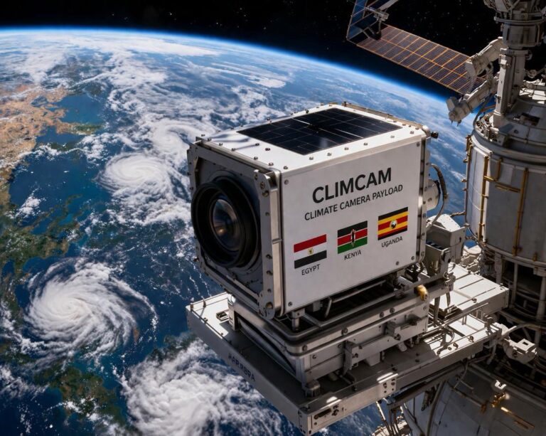
ClimCam lifted off on April 11, 2026, aboard the Cygnus NG-24 resupply spacecraft, launched by a SpaceX Falcon 9 rocket from Cape Canaveral, Florida.
TECH NEWS
A joint climate-monitoring camera built through a partnership between Uganda, Kenya and Egypt is entering its final commissioning phase this month aboard the International Space Station, moving the tri-national space project closer to delivering the near-real-time weather and climate data it was designed to provide across East Africa. The payload, known as ClimCam, was launched to the ISS in April and is expected to begin transmitting operational imagery and climate products to ground teams in all three partner countries once commissioning concludes.
ClimCam lifted off on April 11, 2026, aboard the Cygnus NG-24 resupply spacecraft, launched by a SpaceX Falcon 9 rocket from Cape Canaveral, Florida. It was subsequently installed on the Bartolomeo external payload platform, operated by Airbus and attached to the European Space Agency's Columbus module on the ISS. The mission is a collaboration between the Uganda National Space Programme, the Kenya Space Agency, and the Egyptian Space Agency, described by officials involved as Africa's first tri-national climate satellite project and a milestone in the continent's growing space-science ambitions.
The camera uses artificial intelligence to process imagery and generate near-real-time weather and climate data, a capability its designers say should meaningfully improve how the three partner countries detect and respond to extreme weather events, from droughts and floods to storm systems that regularly affect agriculture and disaster planning across the Horn and East Africa. Following its installation on the ISS, ClimCam entered a roughly 30-day commissioning and validation period, during which engineers test the instrument's calibration and data pipeline before declaring it fully operational; that window falls within August 2026, meaning the coming weeks should determine when the camera's first validated data products become available to researchers and emergency planners.
In Uganda, incoming ClimCam data is expected to be received through the Mpoma Earth Satellite Station in Mukono District, a facility with a long history in the country's communications infrastructure. The station was originally built in 1978 with Japanese support during the government of Idi Amin and has historically supported Intelsat satellite links over both the Atlantic and Indian Ocean regions. In recent years it has been rehabilitated and upgraded, including work contracted to the National Enterprise Corporation, to allow it to communicate with a wider range of spacecraft and to support what officials describe as a "ground station as a service" model, in which Uganda could commercially or collaboratively host communications for satellites belonging to other nations. For ClimCam specifically, data is expected to be downlinked to Mpoma at a rate of around 1 megabit per second, feeding into national systems for weather forecasting, agricultural monitoring and disaster management. The three partner agencies have also outlined plans for a joint online data portal intended to give researchers and emergency responders across the region direct access to ClimCam imagery and climate alerts.
The mission builds on Uganda's earlier, higher-profile entry into space science: PearlAfricaSat-1, the country's first satellite, launched into low Earth orbit in November 2022 under the Japan-led BIRDS-5 programme, in partnership with NASA, which handled the launch from the Wallops Flight Facility in Virginia. That CubeSat was designed and built substantially by Ugandan engineers, including Edgar Mujuni, Bonny Omara and Derrick Tebusweke, and was intended to supply data across six priority areas: weather forecasting; land, water and mineral mapping; agricultural monitoring; infrastructure planning; border security; and disaster prevention. PearlAfricaSat-1's development and the subsequent lessons learned from operating it fed directly into upgrades at Mpoma and into planning for follow-on missions, of which ClimCam is the most prominent regional collaboration to date.
ClimCam's commissioning also arrives against the backdrop of a broader push by Uganda's government to position science, technology and innovation as central pillars of long-term economic growth. Earlier this year, the Ministry of Science, Technology and Innovation, led by Minister Monica Musenero, staged National Science Week 2026 at Kololo Independence Grounds under the banner "STI Works, Powering Uganda to a $500 Billion Economy," showcasing more than 200 market-ready local innovations across agriculture, health, manufacturing and clean energy, alongside a hackathon whose winning teams secured 300 million Ugandan shillings to help commercialize their prototypes. While that event predates the current news cycle, it reflects the same policy emphasis now visible in the government's continued investment in space science and satellite infrastructure: a bet that homegrown technical capacity, rather than purely imported technology, can underpin Uganda's next phase of economic development.
The country's technology calendar remains active in the weeks ahead. Kampala is set to host the inaugural East Africa Open Robotics Championship from August 20 to 22, organized by NextGen Restyling Uganda in partnership with the Ministry of Education and Sports, the Uganda Communications Commission and WorldSkills Uganda. The competition will bring together young roboticists from Uganda, Kenya, Tanzania, Rwanda and other countries, including entrants from as far afield as South Africa, Nigeria, Ghana and Cambodia, to design and program autonomous robots for a series of engineering challenges, part of a broader regional effort to build STEM talent pipelines.
For ClimCam, the immediate milestones to watch are straightforward but consequential: whether the instrument completes commissioning on schedule this month, when the first validated imagery and climate data products actually begin flowing to Mpoma and its counterpart stations in Kenya and Egypt, and when the promised joint online portal opens to researchers and disaster-management agencies. If the system performs as designed, officials in all three countries hope it will provide an early warning tool for extreme weather that has historically been difficult and expensive for individual East African nations to monitor from space on their own, while also demonstrating that regional pooling of scientific and financial resources can deliver space infrastructure none of the three countries could easily build alone.
Longer term, Ugandan space officials have framed ClimCam and the Mpoma upgrades as building blocks toward a more commercially oriented space programme, one that could eventually host or support satellite operations for other African nations and generate revenue rather than functioning purely as a research and disaster-response tool. Whether that ambition materializes will depend heavily on how smoothly the current commissioning phase concludes and how effectively the resulting data is put to use once it starts reaching Ugandan forecasters, farmers and emergency planners in the coming weeks and months.