Written By | Torch Media Africa
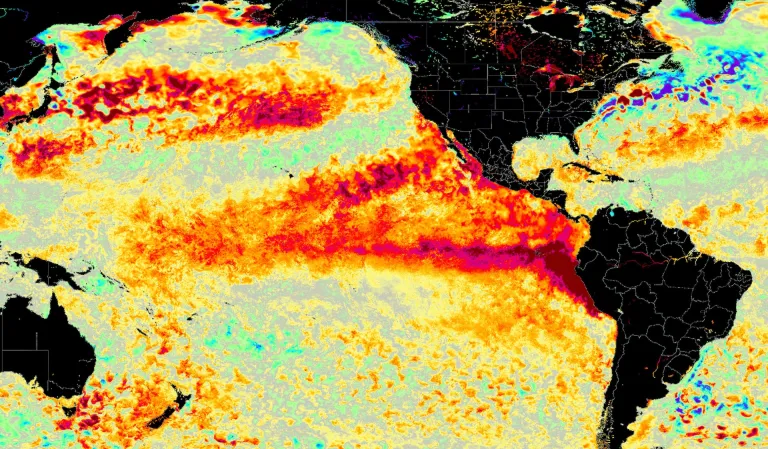
Forecasters say the El Niño now building in the Pacific could be the largest in at least 150 years — and the worst months are still ahead.
GENEVA / LIMA
The fish were simply gone.
Off the coast of Peru sit some of the most productive fishing grounds on the planet — waters that in a normal year surrender millions of tonnes of anchovy, the small silver fish that ends up as fertiliser on farms and feed in fish pens from Norway to Vietnam. It is not a romantic industry. It is an enormous one, and much of the world's protein supply quietly depends on it.
In late August, the Peruvian government cancelled the anchovy season early.
The reason was not overfishing, or a strike, or a storm. It was heat. The El Niño now gathering strength in the tropical Pacific has driven ocean temperatures up, and the full-grown anchovies have fled downwards, chasing cooler, food-rich water into depths the nets do not reach. The fish did not die. They moved — and an entire national industry's calendar collapsed with them.
That, according to a Nature news analysis published on 13 September, is just one example of what this year's monster is already doing. And the forecasters have a warning that should make anybody sit up: El Niño typically peaks between November and February.
The worst of this is in front of us, not behind us.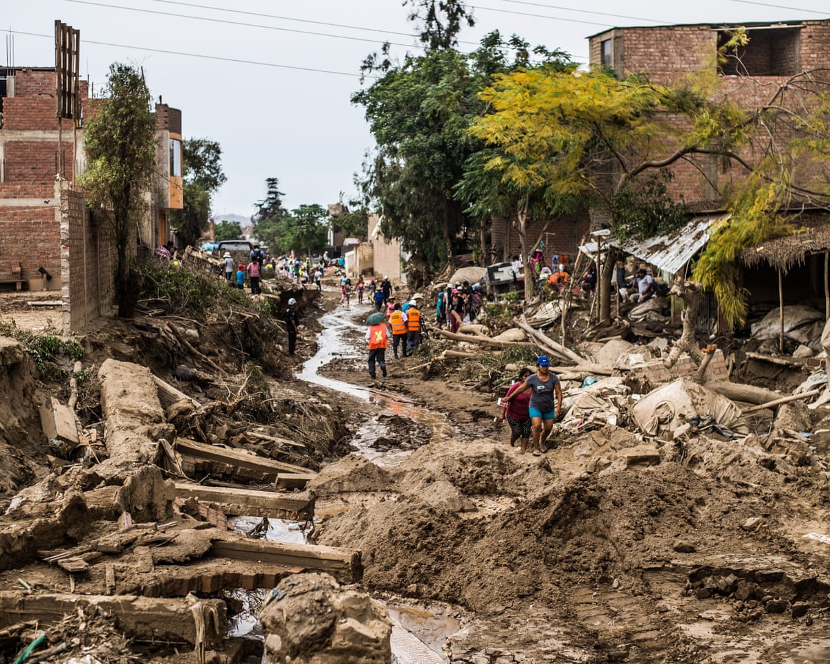
WHAT EL NIÑO ACTUALLY IS
Strip away the mythology and El Niño is a temperature problem that becomes a weather problem.
Every few years — typically every two to seven — sea-surface temperatures in the central and eastern equatorial Pacific climb abnormally high. That warmth heats the air above it. Warm air rises, and when a patch of ocean the size of a continent starts pushing heat upward in a place it normally doesn't, the atmosphere reorganises itself around the change. Wind patterns shift. Storm tracks move. Rain that was going to fall in one place falls somewhere else, or not at all.
El Niño and its cold-water twin, La Niña, are the two phases of the El Niño-Southern Oscillation, or ENSO — which the World Meteorological Organization calls one of the most powerful drivers of year-to-year climate variability on Earth.
Events usually start developing between March and June, peak between November and February, and — crucially — exert their strongest influence on global temperatures during the year after they begin. That lag is why the headline about 2027 is arriving in 2026.
None of this is new. Fishermen on the Peruvian coast named the thing centuries ago, after the Christ child, because the warm water tended to arrive around Christmas. What is new is the size.
"EL NIÑOS COME IN FLAVOURS, LIKE ICE CREAMS"
Here is the part that most coverage skips, and it is the part that determines who gets hit.
Not all El Niños behave the same way. An event driven by warm water in the central Pacific produces a different global weather signature from one centred in the eastern Pacific. A strong event does not simply do what a moderate one does, only more so — it can shift the pattern entirely.
"El Niños come in flavours, like ice creams," says Jérôme Vialard of the Research Institute for Development in Marseille, France.
This one has an eastern Pacific flavour. And according to Eran Vos, a climate scientist at Bar-Ilan University in Ramat Gan, Israel, it is the first strong eastern-Pacific El Niño since the late 1990s.
Read that again, because the implication is uncomfortable. The last time the planet experienced this particular flavour at this particular strength was before the smartphone, before streaming, before roughly three decades of additional global warming were loaded onto the system. There is no modern precedent for how this pattern behaves on top of today's baseline heat.
"You change the patterns and the weather reacts," Vos says.
There is a second wrinkle. This event strengthened earlier than the giants of 1997 and 2015 did — meaning it arrived at a high level with more of the calendar still to run.
THE MAP OF DAMAGE, SO FAR
The early effects, researchers say, broadly resemble those of previous strong events. That is not reassuring — previous strong events were catastrophic.
In Central America, drought has slowed shipping through the Panama Canal, which needs enormous volumes of fresh water to fill its locks for every ship that transits. When the reservoirs fall, the canal throttles traffic, and the cost ripples outward into the price of everything that crosses it.
Tens of thousands of smallholder farmers across Guatemala, Honduras and El Salvador have reported crop losses.
In the Caribbean, a historic drought already worsened by climate change has intensified further. Puerto Rico has moved to water rationing. Jamaica is reporting crop stress.
The hot, dry belt extends around the equator. Indonesia has seen an above-average start to its wildfire season. India has had a lower-than-average monsoon — even as flooding hit parts of the country, which is itself a textbook El Niño signature: less rain overall, delivered more violently when it does come.
In parts of southern and East Africa, dry weather has collided with high fuel and fertiliser prices, and food security is the casualty.
And then there is the other half of the pattern — the places that get too much water. Heavy rain and snow across Chile and Peru have caused flooding, disrupted copper mining, and closed the Incan citadel of Machu Picchu to tourists. The Horn of Africa is forecast to see flooding on the scale of the 2023 El Niño, which displaced millions of people.
Looking ahead, Deepti Singh, a climate scientist at Washington State University in Vancouver, says forecasts for the coming months point to impacts in most of the regions normally associated with El Niño's reach: drought around the equator, in Central America and the western Pacific; extreme rainfall in the Horn of Africa, the western United States and along the Pacific coast of South America.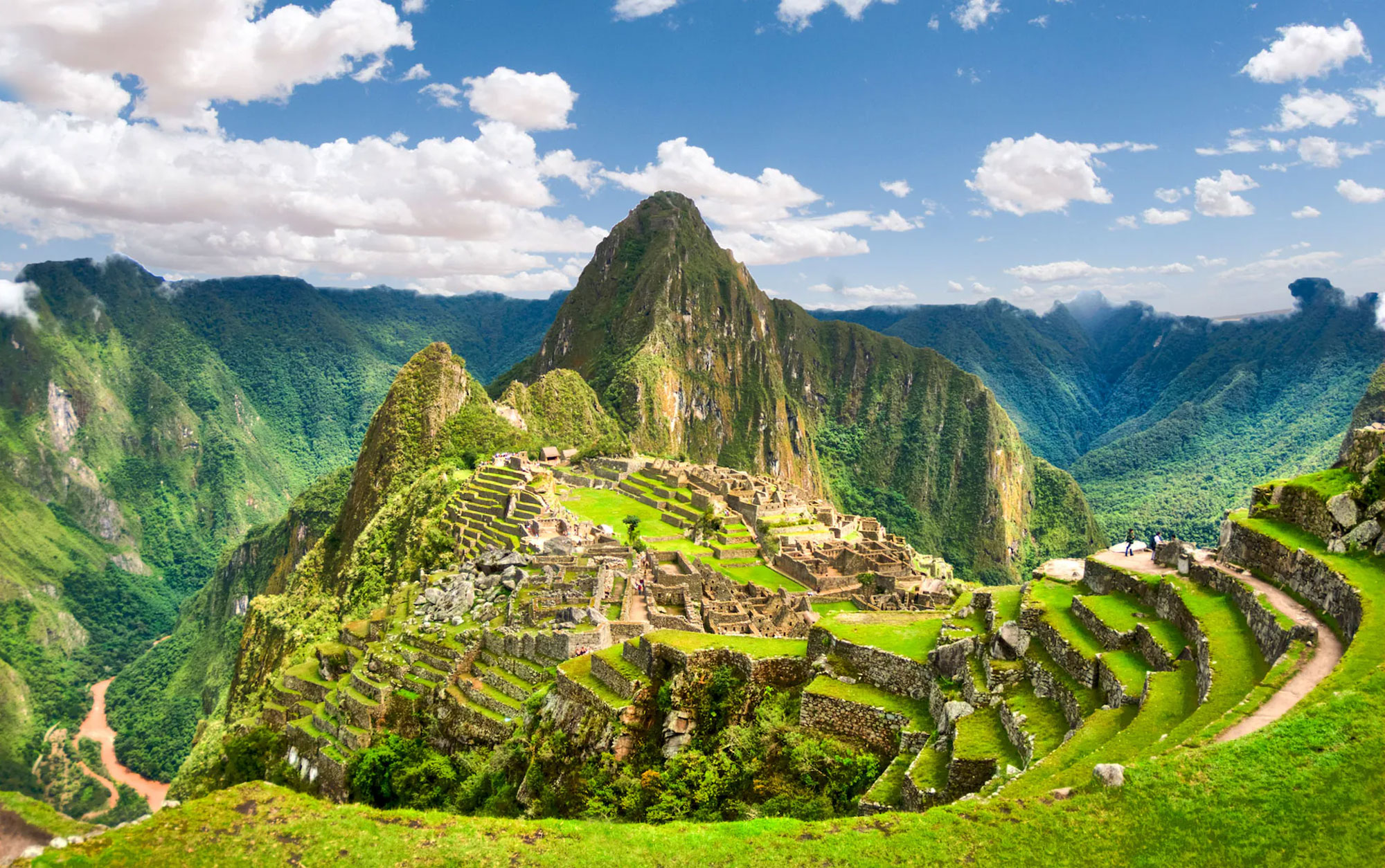
Machu pichu, Peru
THE NUMBER THAT WORRIES FORECASTERS
El Niño's strength is measured by how far sea-surface temperatures in a monitoring region of the equatorial Pacific, known as Niño3.4, rise above normal.
For context, the two events that define the modern record are 1997-98, which peaked around 2.4°C above normal, and 2015-16, at roughly 2.6°C. Those events are remembered because they rearranged weather across the planet.
Forecast members from the European Centre for Medium-Range Weather Forecasts have projected this event peaking somewhere between 3.0°C and 4.0°C by late in the year — with central projections around +3°C by December and high-end scenarios pushing beyond +4°C.
In July, at a press briefing reported by Nature, researchers said the event is on track to be the largest in at least 150 years. One scientist described the margin over the previous record as "mind-blowing".
The World Meteorological Organization, which tends towards careful institutional language, put it this way in its July statement: multi-model ensemble forecasts from leading global centres showed "consistent and significant warming" across the central and eastern equatorial Pacific, with seasonal-average anomalies expected to exceed 2°C in key monitoring regions, and "remarkable agreement" between models giving high confidence in the outlook.
When independent forecasting centres on different continents all agree, that is usually the moment to stop arguing about the forecast and start preparing for it.
2027: THE RECORD THAT'S ALREADY BEING SET
Because El Niño releases stored ocean heat into the atmosphere, and because its temperature effect lands hardest the following year, the consequence is grimly arithmetic.
Forecasters now put the chance of 2027 becoming the warmest year in the instrumental record at around 95 per cent.
Not a possibility. Not a risk. A near-certainty, assigned more than a year in advance.
It is worth being clear about what that does and does not mean. A record year driven partly by El Niño is not evidence that warming has suddenly accelerated — natural variability rides on top of the long-term trend, and a big El Niño year is a spike on a rising line, not a new line. The following year usually comes back down a little.
But it comes back down to a higher floor than before. That is the whole problem.
THE PHRASE SCIENTISTS WON'T OFFICIALLY USE
You have read "super El Niño" in a hundred headlines this year. You will not read it in a WMO document.
The organisation classifies ENSO events as weak, moderate, strong or very strong — and states explicitly that "super El Niño" is not part of its operational classification system and is therefore not used in official WMO products.
This is not pedantry, and it is not the scientists spoiling the fun. It matters because the label is doing work that the data has not authorised it to do. "Super" implies a category. It implies a known thing with known consequences. What forecasters actually have is a very strong event, with an unusual flavour, arriving early, on top of an unusually warm baseline — which is a more specific and a more unsettling description than any single adjective.
The WMO also stresses something that gets lost in the drama: impacts vary by intensity, by duration, by the time of year the event develops, and by how it interacts with other climate patterns such as the Indian Ocean Dipole. Not every region is affected. Within a region, effects can differ. And extreme weather happens in neutral years too.
El Niño loads the dice. It does not throw them.
$202 MILLION AND THE ARITHMETIC OF PREVENTION
The humanitarian system, to its credit, saw this coming and moved early.
In June, the UN's Food and Agriculture Organization and the World Food Programme launched their first-ever joint anticipatory action appeal, seeking $202 million to protect roughly 8.8 million people across 22 high-risk priority countries. A WFP report projected that tens of millions of people in the worst-affected regions face acute food insecurity as a result of the event.
The money is not for emergency response after the disaster. It is for the window before it — cash transfers to families so they don't sell their livestock, drought-tolerant or flood-resistant seed, livestock support, flood defences, water storage.
And the agencies make an argument that ought to be uncontroversial and somehow never is: every dollar invested in anticipatory response can result in up to seven dollars in avoided losses and response costs.
Seven to one. That is the return on acting before the flood instead of after it.
WMO Secretary-General Celeste Saulo described the mobilisation now under way as unprecedented, coordinating across UN agencies and regional bodies. "Advanced seasonal forecasts and early warnings are vital to save lives and cushion the impact on our economies and our communities," she said.
The uncomfortable part is what history suggests happens next. Anticipatory appeals are routinely underfunded, because money moves when cameras arrive, and cameras arrive after the damage.
WHAT THIS MEANS FOR YOU
If you live in a region on the map above, the practical advice is straightforward: pay attention to your national meteorological service, not to social media, and pay attention now rather than in December. Seasonal forecasts have improved dramatically, and — as WMO forecasters have pointed out — the development of this event was anticipated accurately months in advance. Early warning only helps if somebody acts on it.
If you don't live in one of those regions, you are still going to feel this, and here is how.
Food prices. Peru's anchovy collapse feeds directly into global fishmeal costs, which feed into farmed fish and livestock costs, which feed into what you pay. Simultaneous crop stress across Central America, the Caribbean, India and southern Africa compounds it.
Shipping. A constrained Panama Canal means longer routes, higher freight rates and delays that show up weeks later on shelves.
Commodities. Disrupted copper mining in Chile and Peru — which together dominate world supply — touches the price of everything electrified, from wiring to grid infrastructure.
Insurance. Large-scale flood and drought events reprice risk, and repriced risk arrives in premiums.
Research published in Science has estimated that major El Niño events impose economic costs that persist for years afterwards, well beyond the months of unusual weather themselves.
This is the thing people underestimate about El Niño. It is not a weather event that happens to some people far away. It is a global rearrangement of where rain falls, and almost everything humans do depends on where rain falls.
THE LAST WORD
There is a version of this story that is pure spectacle: monster in the Pacific, records shattered, apocalypse at Christmas. That version is not quite true, and it is also not necessary, because the accurate version is alarming enough.
An enormous natural climate oscillation has arrived early and strong, wearing a flavour the modern world has not seen at this scale, on top of a planet substantially warmer than the last time this particular combination occurred. Forecasters agree on the physics with unusual unanimity. The consequences are already visible in cancelled fishing seasons, rationed water, closed monuments and constrained canals. The peak is still two to five months away. And next year is, with near-certainty, going to be the hottest ever recorded.
The one genuinely hopeful thread in all of this is that we knew. Months ahead of time, with confidence, forecasters said what was coming and roughly where. That is a scientific achievement of the first order, built on decades of ocean buoys, satellites and modelling that nobody puts on a magazine cover.
The question that will be asked in 2028, when the reports are written, is not whether the warning came.
It is whether anybody funded it.