Written By | Staff Writer
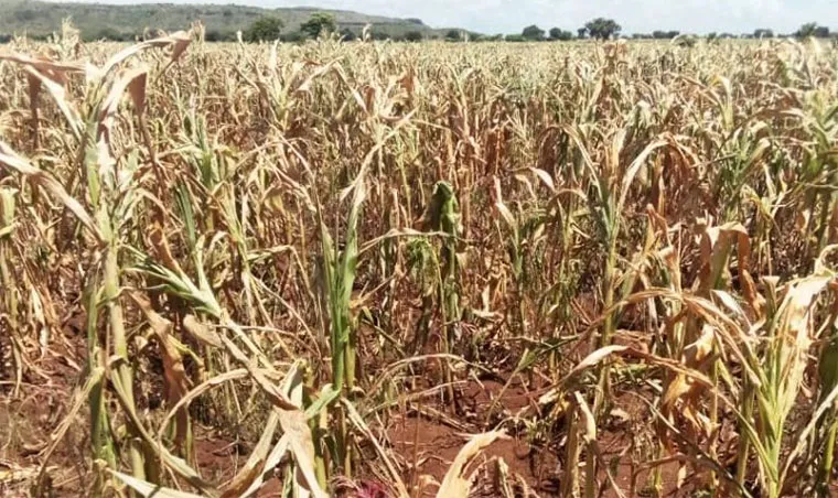
Forecasters say the September-to-December season is still on track, but a dry September has already cost farmers planting time, and the real test begins now.
Uganda Agriculture
For weeks, Ugandan farmers were told to brace for an El Niño deluge. What many got instead was a dry September: thin showers, long gaps between them, and gardens that were prepared but not planted. On 15 October, as the first widespread rains finally arrived, Uganda's meteorologists were forced into an unusual task: explaining why the much-advertised wet season had seemed to go missing.
The explanation, offered in a report carried by The Observer on 15 October, goes to the heart of how seasonal forecasts are read, and misread, by the people whose planting calendars depend on them. For a country where the great majority of farmers rely on rain rather than irrigation, the gap between what a forecast says and what farmers hear can be the difference between a good second harvest and a lost one.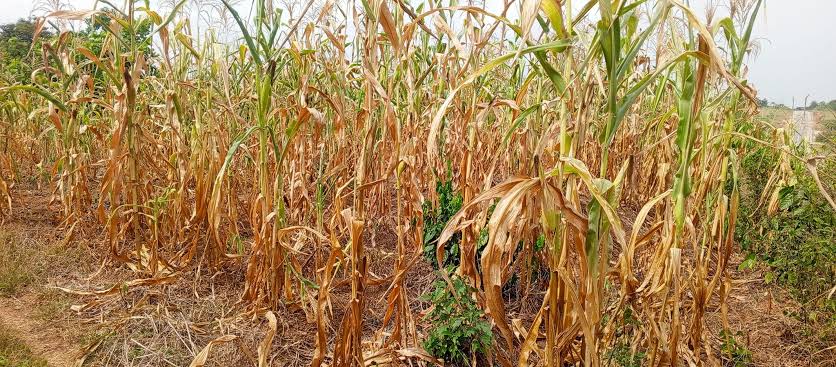
What forecasters are now saying
William George Omony, a principal meteorologist at Uganda's Department of Meteorological Services, told the report: "We are not communicating well to the public." His department says its September-to-December outlook remains valid. That outlook projected near-normal rainfall with a slight tendency toward above-normal in south-western Uganda and Karamoja, with rains starting intermittently in mid-to-late September and becoming more consistent from mid-October. Widespread rain was recorded on 9 October, and the season is expected to peak between late October and mid-November, easing in northern Uganda around late December and in the south-west in early January.
Eunice Koech, a climate modelling assistant at the IGAD Climate Prediction and Applications Centre (ICPAC), put the central misunderstanding bluntly: "El Niño doesn't mean heavy rainfall." She noted that El Niño, declared in June 2026, tends to bring wetter conditions across most of the region from October to December when it coincides with a positive Indian Ocean Dipole, and that the Madden-Julian Oscillation can shift the timing of rain within a season. In other words, a wet season in aggregate does not guarantee wet weeks on the farmer's schedule.
The Ministry of Water and Environment's seasonal statement, issued on 31 August, had anticipated much of this. It forecast near-normal to above-normal rainfall for September to December, with most of the country expected to receive about 25 percent more rain than the long-term average, and dry conditions persisting in parts of the central and western Lake Victoria region until mid-to-late September. Some areas, it said, might keep receiving rain into January 2027.
A costly September
The forecast was broadly right about timing. The problem was what the dry spell did before it ended. The Observer report records that September rainfall was below average and rainy days were fewer in parts of Uganda, disrupting land preparation, planting and seedling establishment. The Famine Early Warning Systems Network (FEWS NET), in its September seasonal monitor, likewise noted that light showers since early September might prompt early planting but that totals remained below the long-term average, and that subseasonal forecasts pointed to below-average rain from mid-September to early October before wetter conditions set in.
The damage was concentrated where the dry weather had already been biting. The Monitor reported on 4 September that farmers across greater Masaka, including Kyotera, Rakai, Bukomansimbi, Lwengo, Mpigi and Gomba, had endured three consecutive months of inadequate rain. Coffee flowers and berries had dropped, young seedlings had wilted, and some farmers had lost entire plantations; one Mpigi farmer, Francis Ssendyowa, described losing a three-acre plantation that he had expected to yield Shs30 million to Shs45 million a season. Cassava and banana gardens had withered, and farmers such as Joseph Kabuye in Lwengo, who had expected a November-December harvest, were warned that a mini-harvest was likely to fail.
FEWS NET adds the wider picture: poor distribution in the March-to-May season produced extreme moisture deficits from April in bimodal zones, rainfall in unimodal areas was extremely poor between June and September, and production in Karamoja is expected to be below average after hot, dry conditions from April to August hurt sorghum. Harvests in Masaka, Mbarara and Bushenyi were nonetheless favourable because planting and rain onset had been timely, a reminder of how narrowly the margin between a good and a poor season is drawn.
The next risk is the opposite one
With rains now establishing, the concern shifts from drought to excess. Wetter conditions raise flood and waterlogging risk, and FEWS NET names Kampala among urban areas at risk. The Observer report points to the same hazard: above-average rain can recharge water sources and support crops, but it also brings flooding, waterlogging, landslides and transport disruption. For farmers who planted late into soil that is suddenly saturated, seedlings can be lost as surely as in a drought, and feeder roads that carry produce to market can become impassable.
Fishing communities are in the frame too. In the Kenyan portion of Lake Victoria, communities in Homa Bay, Siaya and Kisumu raised concerns about rising lake levels and water hyacinth, and the report notes a need to turn seasonal forecasts into practical preparedness for lakeshore groups and Beach Management Units, a lesson equally relevant to Ugandan landing sites.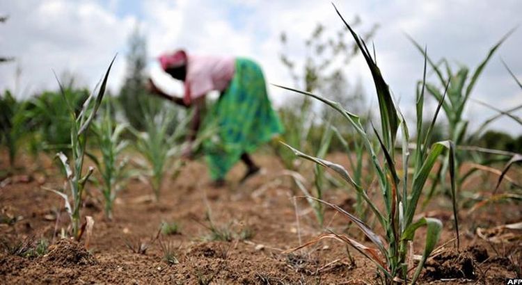
What it means for farmers and markets
The immediate implication is about planting decisions. Farmers who have not yet sown second-season crops face a narrowing window: plant too early and a dry spell can recur; plant too late and the crop may miss the tail of the rains in the north, which are expected to fade around late December. Short-maturing, drought-tolerant varieties, which NARO has been promoting in places such as Karamoja, become more valuable in such a squeeze, as does mulching, drainage and planting on ridges where waterlogging is a threat.
For markets, the late start matters because second-season food crops such as maize, beans and cassava feed the early-2027 supply. A delayed or reduced harvest tends to push food prices up in the lean months, a worry given that national inflation has already been driven by food costs. For coffee, a dry September that cut flowering in parts of Masaka and elsewhere could trim the volume of the next harvest, even though a good rainy season will help trees recover for the following cycle.
The communication problem the meteorologists identified is also an economic one. If farmers hear "El Niño" and assume guaranteed abundance, they may over-invest in inputs ahead of rains that arrive late or unevenly. Mr Omony's admission suggests the department will need to translate probabilities into plain, local, week-by-week guidance, delivered through extension officers, radio and mobile messaging, and not merely seasonal outlooks.
The takeaway
Uganda's meteorologists maintain that the season is behaving as forecast, and the rains of 9 October support that. But the experience of September shows that a seasonal average can hide costly gaps, and that smallholders without irrigation carry the risk of those gaps entirely. The weeks between now and mid-November, when rainfall is expected to peak, will determine whether this El Niño season rescues the year's second harvest or adds floods to a year already scarred by drought.