Agriculture
"My people have lost their land. What is the government of Uganda going to do about that?" Amolatar Woman MP Agnes Auma Okao put the question bluntly to Parliament's Committee on Climate Change on August 30, as it toured Acii Sub-county to see for itself what four years of rising water on Lake Kyoga and Lake Kwania have done to one of northern Uganda's food-producing districts. The answer, as things stand, is that entire villages have effectively become lakebed, more than 3,000 households across eight villages have been cut off by a submerged access road, and a government dam project meant to help manage the water has swallowed more than Shs600 million without being finished.
The Amolatar crisis is not a single flood event. It is a slow, grinding inundation that has been advancing since 2022, and it has now reached a scale that district and national leaders both concede is beyond local capacity to manage. Kyoga County North MP Geoffrey Ocen Kiring, addressing the same committee session at Acii Primary School on August 31, described families who had lived on their land for 50 years or more now watching it disappear beneath the lake "day and night." He is demanding that government commission specific scientific research into why the water keeps rising, rather than continuing to treat each flood season as an isolated weather event.
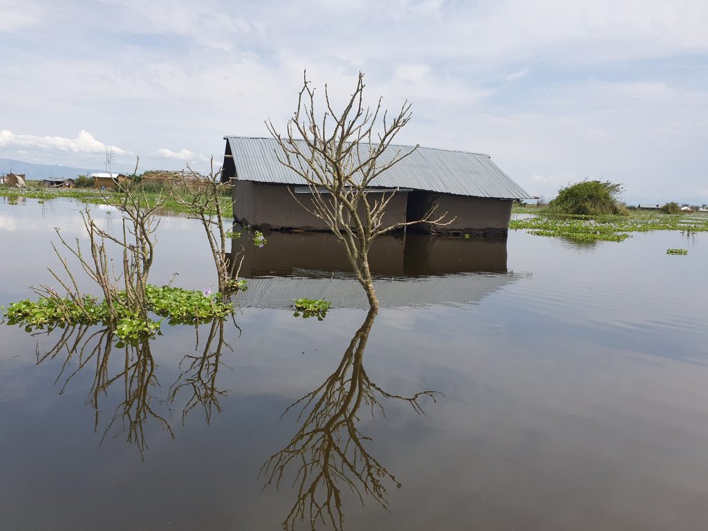
The submersion is not confined to homesteads. Farmland — cassava gardens, simsim plots, rice paddies and grazing land that anchor household food security in the sub-region — has gone under along with the houses built beside it. The road linking Acii to Muchora parish, a lifeline for eight villages, is now impassable, isolating communities from health centres, schools and markets. Amolatar District Chairperson Morish Ogwal Omara told MPs the scale of displacement has overwhelmed the district's budget, and pressed the committee to investigate why a Ministry of Water and Environment dam project at Orimai Cell in Amolatar Town Council — meant in part to help regulate water levels — has consumed Shs600 million in public funds without being completed.
A regional pattern, not a local anomaly
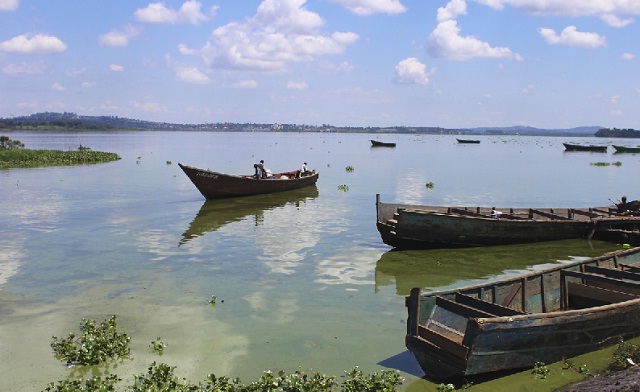
Amolatar is the most acute case, but it is not isolated. Neighbouring Dokolo District has faced its own version of the same crisis on the Lake Kwania shoreline, where rising water displaced more than 1,000 households as far back as 2024, submerging cassava and simsim gardens along the Akwate shoreline and destroying latrines and water points faster than relief agencies could replace them. Dokolo North MP Joseph Jones Ogwal told the August 30 committee session that his constituency is seeing similar isolation around Bata Inland today, and pledged to coordinate with Amolatar's delegation to push Parliament for a joint relief response rather than piecemeal district-by-district appeals. Similar upward trends have also been recorded on Lake Albert, suggesting the phenomenon extends across Uganda's Rift Valley and Kyoga basin lake systems rather than being peculiar to any one catchment.
Environmental researchers who have studied the pattern point to degraded catchments — deforested mountain slopes, denuded riverbanks and encroached wetlands upstream — as the dominant driver, arguing that vegetation loss around the feeder rivers has reduced the land's capacity to absorb rainfall before it reaches the lakes, pushing more water downstream faster and raising base levels over successive rainy seasons. That diagnosis sits awkwardly alongside Uganda's own wetland enforcement drive: the National Environment Management Authority has spent much of 2026 evicting farmers from wetlands in districts such as Rukungiri and Ngora specifically to protect catchment function, even as the farmers being displaced argue they need that land to survive. The Amolatar crisis is, in effect, a preview of what NEMA's restoration campaigns are trying to prevent — and a reminder that catchment damage several districts away can drown farmland far downstream, long after the trees that once held the water back are gone.
El Nino raises the stakes further
The timing could scarcely be worse. Uganda's Ministry of Water and Environment, through the Department of Meteorological Services, has been warning since a late-July advisory that the country faces a heightened risk of above-normal rainfall between August and December 2026, driven by an emerging weak-to-moderate El Nino event that could persist into 2027. The ministry has urged local authorities to clear drainage channels, discourage settlement in flood-prone areas and prepare agriculture-sector contingency plans. For lakeshore communities in Amolatar and Dokolo, that advisory is not a future risk to plan around — it is confirmation that the water now standing where their gardens used to be is unlikely to recede before more rain arrives, and may well rise further before the wet season ends in December.
That has direct implications for a district already grappling with an emerging pattern this reporting has traced elsewhere in Uganda this month: sudden windstorms and rainstorms destroying banana, cassava and sugarcane crops in western districts such as Rwampara, even as El Nino models point toward wetter-than-normal conditions nationally. Amolatar's difference is duration rather than intensity — this is not a single storm event farmers can recover from in a season, but a permanent redrawing of the shoreline that leaves previously productive land unusable indefinitely.

An insurance and compensation gap
Uganda's Agriculture Insurance Scheme, which passed the milestone of one million insured farmers earlier this month, offers satellite-index cover against drought and, increasingly, excess-rainfall risk. But the scheme's design — built around discrete weather-index triggers over a cropping season — is not obviously suited to slow, multi-year lake encroachment of the kind Amolatar is experiencing, where the loss is not a single bad harvest but the permanent removal of land from cultivation. Lakeshore smallholders in Kyoga County and Dokolo are, by most accounts, overwhelmingly uninsured, leaving them dependent on ad hoc relief distributions from the Office of the Prime Minister — supplies that, as Dokolo's 2024 experience showed, tend to run out long before the water recedes, forcing displaced families to rely on NGOs to fill the gap.
Committee chairperson Aggrey Bagiire, the Bunya West MP, told the Amolatar leaders their concerns would be compiled into a report for presentation to Parliament, and framed the response as a national rather than purely local obligation. "It will make a lot of sense if someone from Bugisu, like me, is talking about an issue in Northern Uganda," he said, pledging cross-regional MP support to push the matter forward. Whether that translates into the resettlement land, compensation and completed water-management infrastructure that Amolatar's leaders are demanding remains, for now, an open question — one that will matter increasingly to food security and displacement planning across Uganda's lake basins as El Nino-linked rainfall intensifies through the rest of 2026.
What is at stake for the wider economy
The Kyoga and Kwania basin is not a marginal farming zone. Amolatar and Dokolo sit within a broader northern and eastern agricultural belt that supplies cassava, simsim, rice and fish to regional markets, and the same lake systems support a fishing economy already under strain from separate enforcement crackdowns on illegal gear and mukene harvesting elsewhere on Lake Victoria and Kyoga. A permanent contraction of cultivable lakeshore land compounds pressure on a food system already absorbing shocks from drought-driven crop failure in Karamoja and Acholi, coffee-flower losses from this year's drought-to-flood whiplash in central and western Uganda, and a national fertiliser-use gap that leaves productivity low even on land that is not underwater. For Amolatar's displaced farmers, the immediate need is resettlement land and compensation. For Uganda's agricultural planners, the episode is a case study in how climate-driven hydrology, not just erratic rainfall on cropland itself, is becoming a distinct and under-addressed threat to the country's food-producing geography.
Published By | Features Editor