Written By | Staff Writer
The drought-making El Niño is now forecast to bring heavy rain from late October. Whether that is a recovery or a second blow depends on preparation.
Feature
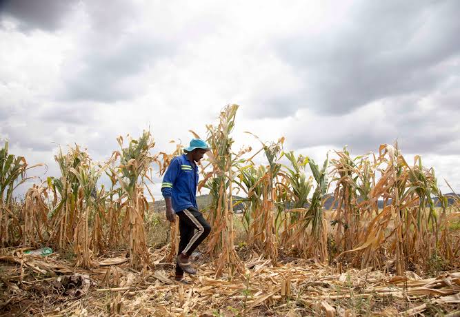
For most of 2026, Uganda's weather story has been about too little rain. Northern Uganda's first-season crops withered, Karamoja lost most of its sorghum, and farmers from Amuru to Kakumiro were told to dig bottle-drip irrigation kits into their gardens. Now the forecasts are flipping the script. The Ministry of Water and Environment, the national meteorological service and international monitors are all saying the same thing: the El Niño that caused the dry spell is expected to deliver unusually heavy rain between late October and January. For farmers who have just survived a drought, the risk is that a good season arrives in a form they are not ready to use.
The warning is not new in itself; what is new is how specific and how local it has become. This week's picture, assembled from the ministry's seasonal outlook, a famine-early-warning update and district-level alerts, is of a second season that could be both the best chance of recovery and a fresh source of losses.
What the forecasters are saying
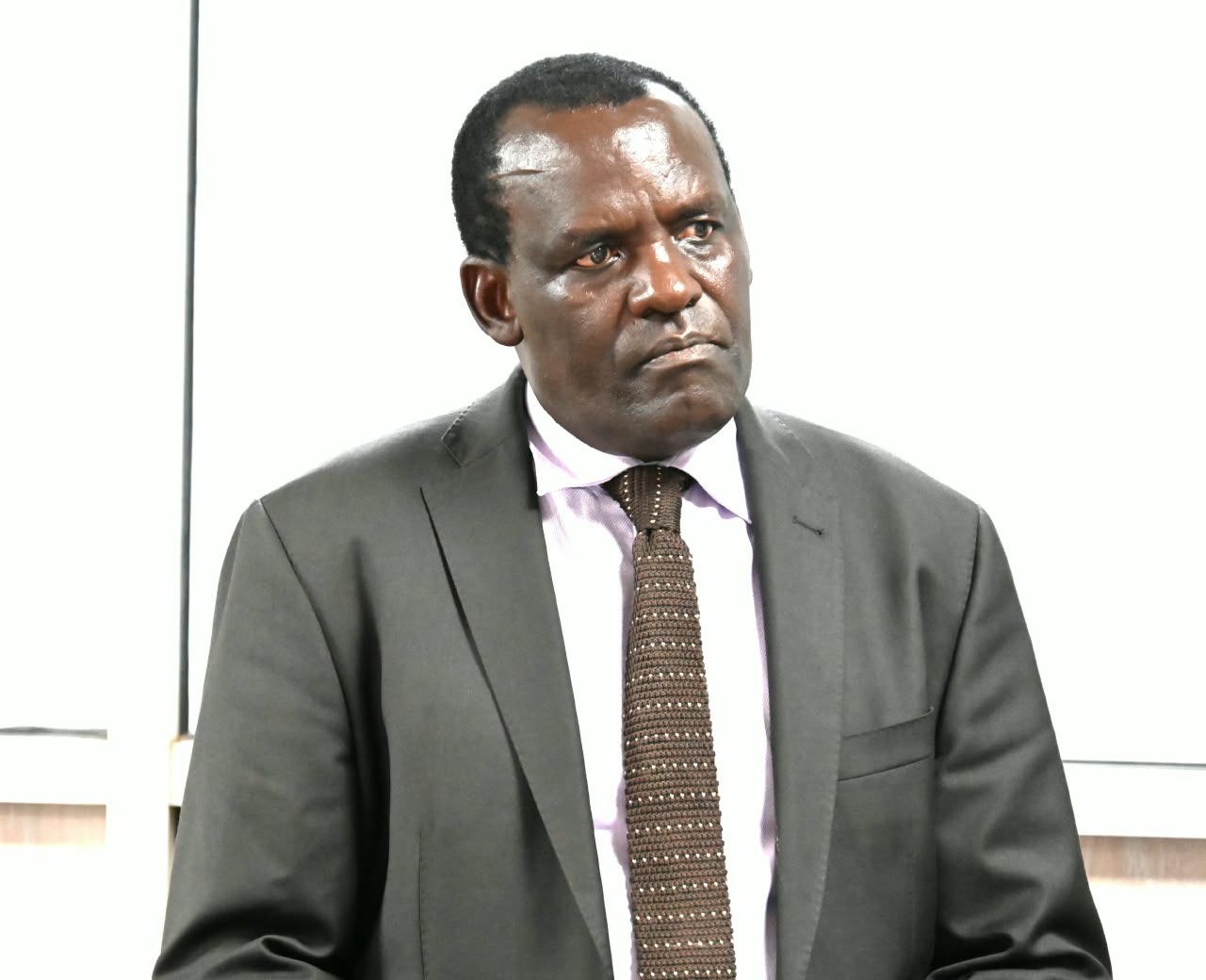
On 1 September, Dr Alfred Okot Okidi, Permanent Secretary in the Ministry of Water and Environment, told reporters that most of the country should expect near-normal to above-normal rainfall and warmer-than-average temperatures from September to December, potentially running into early January 2027. "The El Niño episode is expected to intensify during the season," he said, which "suggests an increased likelihood of enhanced rainfall, particularly over the Central, Northern and Eastern regions of Uganda." New Vision reported the peak as late October through November, with an uplift of about 25 percent above average in the hardest-hit areas.
The outlook breaks down by region. Central Uganda and the Lake Victoria basin are expected to see above-normal rain; Eastern Uganda is forecast to peak from mid-October through November; Hoima, Kikuube and Masindi in the west are tipped for above-normal totals; and West Nile also looks wet. Northern Uganda is expected to be near-normal to slightly above, which matters because that is where the drought bit hardest. The ministry points to El Niño intensification and a transition of the Indian Ocean Dipole to a positive phase as the drivers.
The Famine Early Warning Systems Network, in its September seasonal monitor, described a "very high probability of above-average rainfall" spreading westwards towards the Lake Victoria Basin, Burundi, Rwanda and Uganda. It said this should help second-season planting and pasture regeneration, but also raised flooding risk in places such as Kampala. In July, meteorologist George William Omony had told Acholi farmers to delay second-season planting until steady rains set in, noting that sea-surface temperature anomalies had reached 1.47 degrees Celsius, well above the 0.8 degree threshold for an El Niño. In other words, the same phenomenon is behind the dry spell farmers have already endured and the wet spell they are now being told to expect.
From the drought to the deluge
The farm-level damage from the first half of the year is well documented. Nile Post reported in July that farmers in Amuru and Arua lost maize, sorghum and soybeans after almost two months with little rain. One Amuru farmer, Pascal Osire, said he had put Shs47 million into around 100 acres and expected a harvest worth Shs250 million, but now expects to recover less than Shs20 million. FEWS NET's August update put crop losses in Karamoja at 50 to 75 percent across most areas, with rainfall 200 to 300 millimetres below average between June and late August. It said Crisis (IPC Phase 3) outcomes should persist across Karamoja through January even if November and December rains arrive, and that the worst-affected households could slip into Emergency.
That is the catch. Rain arriving after a failed season does not instantly repair household food stocks, seed supplies or debts. Farmers who lost a harvest may have little cash to buy seed, and those who sold livestock to survive have fewer animals to plough or fertilise. Heavy rain falling on drought-hardened, bare soil also runs off rather than soaking in, which is why catchment management and erosion control sit near the top of the ministry's advisory list.
Where the risk is sharpest
Local authorities have started translating the national forecast into local warnings. On 18 September, Kisoro District Environment Officer Unice Akankwasa warned residents to brace for heavy rain, floods, landslides and lightning through 2027, citing forecasts of rainfall patterns "unlike any recorded in the past 150 years", according to allAfrica. Kisoro's steep terrain around the Virunga range makes runoff especially dangerous, and the district has recent history: flash floods in February 2026 destroyed crops and damaged the road to Mgahinga Gorilla National Park, and mudslides in May 2023 killed at least 10 people.
Red Pepper's summary of the national advisory lists the Rwenzori, Kigezi and Elgon sub-regions and the Lake Kyoga basin among the areas to watch, along with Kampala, and names the Nyamwamba, Manafwa, Namatala, Kafu, Awoja and Onyama rivers as flood hotspots. For agriculture, this reads as a map of some of the country's most productive and most densely farmed land: the Mount Elgon coffee and banana belt, the Kigezi highlands' vegetables and potatoes, and the rice and wetland gardens around Kyoga. The Department of Meteorological Services' advisory of 4 August urged people to clear drainage channels and floodways and to avoid settling or cultivating in flood- and landslide-prone areas, a message that is easier to give than to follow where land is scarce and wetlands are the only available plots.
What it means for farmers and markets
For smallholders, timing is everything. If the rains behave as forecast, planting in September and early October could produce a good crop, which is what the Ministry's own messaging stresses: rains "could simultaneously benefit agriculture and water supplies if communities prepare adequately". The practical steps are unglamorous: planting on contour lines, digging trenches and drainage in hillside gardens, staggering planting dates to hedge against a flooded week, and having a plan for drying and storing the harvest, because a wet harvest season invites mould and aflatoxin. The ministry also urges water harvesting and storage through dams, so that excess rain can be saved for the dry months that follow.
For markets, a good second season in the north, if it comes, would eventually ease food prices in a region where hunger has been severe. FEWS NET expects near-average harvests in bimodal areas in December and January to bring modest relief, and noted that rural staple prices were near or below five-year averages even as fuel-driven transport costs lifted urban prices. But wet weather has its own price effects. Washed-out feeder roads raise the cost of moving produce, flooded fields cut quality, and farm-to-market bottlenecks can leave one district with a glut and another with a shortage.
There is also a national-budget angle. Parliament approved Shs9 billion for the Meteorology Department in 2026/27 as part of a Shs1.013 trillion allocation to the Ministry of Water and Environment, as reported by Nile Post in July. Forecasts only help farmers if they reach them in a usable form, in local languages and early enough to change what goes into the ground. The Kakumiro bottle-irrigation push and the Kazo micro-irrigation programme, under which government meets 85 percent of equipment costs and farmers 15 percent, show that adaptation is happening, though so far it covers a few dozen farmers at a time.
The bottom line
Uganda has spent the year learning what a failed El Niño season looks like. The next lesson is that the same climate pattern can produce an opposite problem within months. The ministry's advice to store water, protect catchments and keep out of flood-prone ground is sound but only matters if it reaches the districts where gardens are on slopes and river banks. The next six to eight weeks, which the forecasters expect to bring the peak rains, will show whether the country is ready to turn a wet season into a harvest rather than another round of losses.