Written By | Torch Media Africa
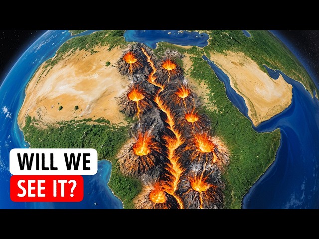
A blob of scorching rock the size of a continent is shoving East Africa sideways — and after twelve years of chasing millimetres with satellites, scientists have finally caught it in the act
Technology & Science Desk
Somewhere beneath your feet — if your feet happen to be planted in Kenya, Uganda, Tanzania, Ethiopia or Malawi — there is a column of rock so hot and so vast that it makes the word “geology” feel embarrassingly small.
It starts near the boundary between Earth's core and its mantle, roughly 2,900 kilometres down. It rises. It leans northeast. It gets shallower as it travels, like a wave building toward a beach. And according to research published this week out of Virginia Tech, it is doing something nobody could previously explain: it is dragging the surface of East Africa in a direction the textbooks said it had no business going. Scientists call it the African Superplume. The rest of us might reasonably call it the monster under Africa.
The mystery that would not go away
The story starts with a stubborn discrepancy — the kind that keeps researchers awake for over a decade.
The East African Rift System is the largest continental rift on the planet, a roughly 3,500-kilometre-long scar running from the Afar region of Ethiopia down through Kenya and Tanzania toward Mozambique. It is the place where the African continent is quite literally coming apart, where the Somali plate is peeling away from the Nubian plate at a rate of a few millimetres a year — about as fast as your fingernails grow.
Textbook rifting behaves predictably. When a continent is pulled apart, the strongest ground motion should run perpendicular to the rift, in the same direction as the pulling. Push a sheet of dough apart with two hands, and the dough stretches along the line of your hands. Simple.
East Africa does that. But it also does something else.
D. Sarah Stamps, an associate professor in the Department of Geosciences at Virginia Tech, spent more than twelve years measuring the region with GPS stations — receivers precise enough to detect movement at the millimetre scale by locking onto signals from more than thirty satellites orbiting some 25,000 kilometres overhead. What she found in the data was a ghost. Parts of the region were not only stretching sideways across the rift. They were also creeping along it, northward, parallel to the very crack that was supposed to be pulling them apart. It was as if the dough were stretching in your hands and simultaneously sliding off the table.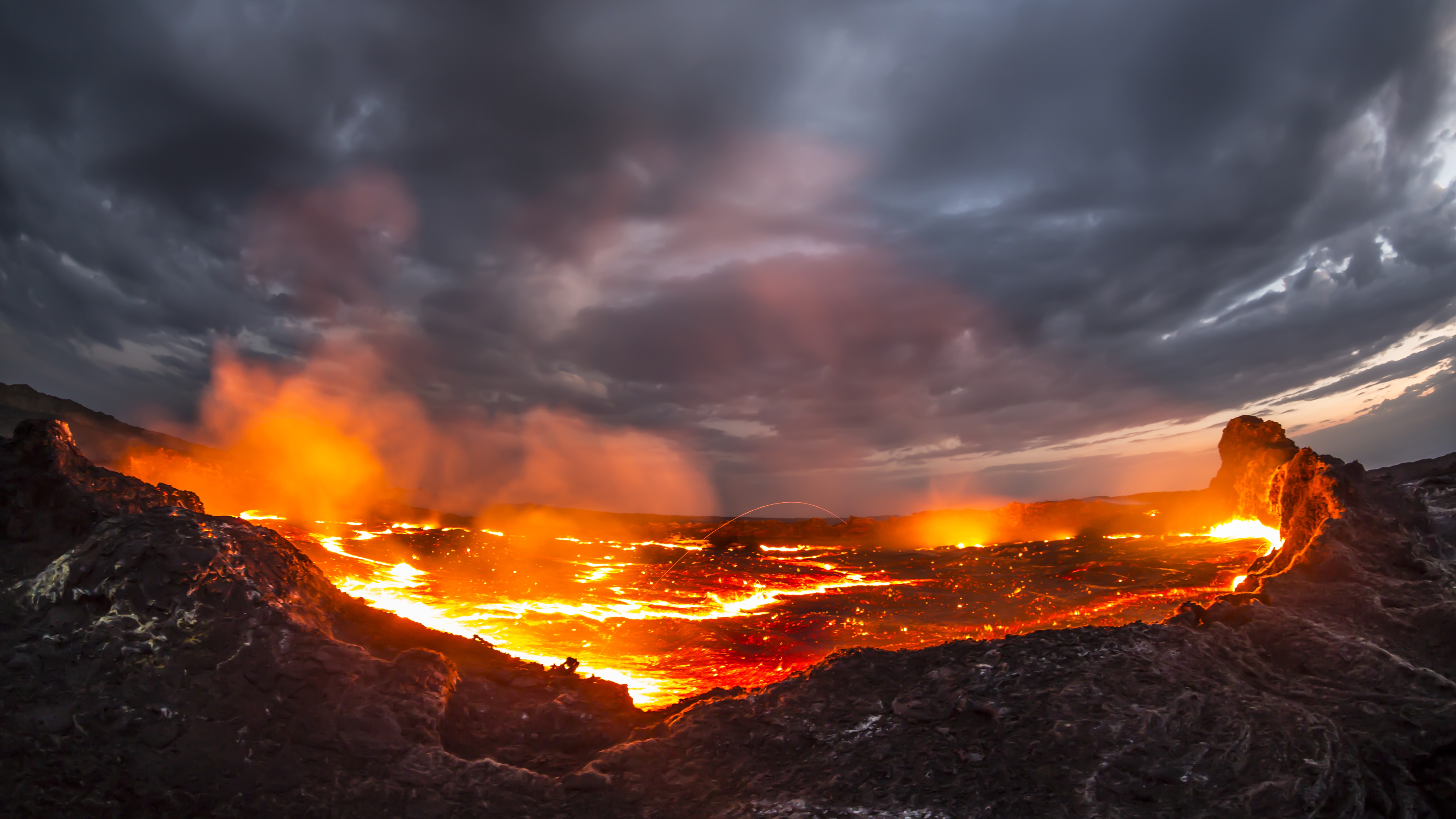
“If you hit Silly Putty with a hammer…”
To understand why that anomaly is so strange, you have to understand that Earth's outer shell does not behave like one thing. It behaves like several, depending on how fast you push it.
Stamps reaches for a toy to explain it.
“If you hit Silly Putty with a hammer, it can actually crack and break,” she said. “But if you slowly pull it apart, the Silly Putty stretches. So on different time scales, Earth's lithosphere behaves in different ways.”
The lithosphere — the crust plus the uppermost slice of the mantle — is the planet's rigid skin. Near the surface, it snaps: that is what faults and earthquakes are. Deeper down, where it is hotter, it oozes. Both are happening in East Africa at the same time, which is one reason the rift has resisted a clean explanation for so long.
For years, the field split into camps. One argued the rift is driven mainly by lithospheric buoyancy forces — relatively shallow effects created by differences in elevation and density within the plate itself. East Africa sits on the African Superswell, an enormous region of anomalously high ground; high ground wants to slide downhill, and that alone generates real tectonic force. The other camp pointed deeper, to mantle traction forces: the flowing mantle beneath the plate physically dragging on its underside like a conveyor belt.
A 2021 study by Stamps's team, published in Geophysical Research Letters, ran three-dimensional simulations and concluded that buoyancy forces could indeed reproduce the normal, rift-perpendicular stretching. What they could not reproduce was Stamps's ghost — the northward drift running along the rift.
So the anomaly sat there. Unexplained. Measured, real, and homeless.
Enter the superplume
The new study, published in the Journal of Geophysical Research, went hunting for the missing mechanism with heavier machinery: 3D thermomechanical models, which simulate not just how rock moves but how heat moves through it and deforms it over geological time.
The modelling was built by first author Tahiry Rajaonarison, now a postdoctoral researcher at New Mexico Tech, who earned his PhD at Virginia Tech working in Stamps's lab. Rather than trying to explain everything at once, he aimed the simulations squarely at the anomaly.
The answer that came back: northward mantle flow associated with the African Superplume.
The Superplume is not a narrow chimney of magma like the one under Hawaii. It is a colossal upwelling of hot mantle material that begins deep beneath southwestern Africa and sweeps northeast across the underside of the continent, rising closer and closer to the surface as it goes. Think less of a candle flame and more of a slow-motion tidal surge inside the planet.
In the models, that surge does exactly what Stamps's GPS receivers had been seeing for over a decade. The deep flow tugs the overlying plate northward, along the rift, producing motion that shallow buoyancy forces simply cannot generate.
“We are saying that the mantle flow is not driving the east-west, rift-perpendicular direction of some of the deformations, but that it may be causing the anomalous northward deformation parallel to the rift,” Rajaonarison said. “We confirmed previous ideas that lithospheric buoyancy forces are driving the rift, but we're bringing new insight that anomalous deformation can happen in East Africa.”
The rocks are combed — and they point the same way
Here is where the result gets genuinely hard to argue with.
A model that reproduces one observation can be a coincidence. A model that reproduces two independent observations, measured by completely different instruments, is something else.
The second observation is called seismic anisotropy. When an earthquake sends waves through rock, those waves normally travel at roughly the same speed in every direction. But if the minerals inside the rock have been combed into alignment — by flowing mantle, by pockets of melt, by ancient structures frozen into the plate — the waves start travelling faster in one direction than another. Seismologists can read that directional fingerprint from thousands of kilometres away.
Beneath the East African Rift, that fingerprint runs parallel to the rift. And in the new simulations, the orientation of the rock lines up with the direction of the Superplume's northward flow.
Two entirely separate lines of evidence — satellites watching the surface from orbit, and seismic waves reading the rock from within — both pointing the same way, both matched by the same model. In science, that is about as close to a fingerprint as the deep Earth is ever likely to give you.
Expert perspective: nobody wins the old argument
It would be tidy to report that the deep-mantle camp has won and the shallow-buoyancy camp has lost. The actual finding is messier, and more interesting.
Both are right. Neither is sufficient.
Lithospheric buoyancy forces still appear to do the heavy lifting on the main event — the ordinary east-west stretching that is prying Africa open. But layered on top of that, deep mantle flow from the Superplume is adding a northward shove that shows up in the GPS record and in the seismic signature beneath the rift.
“We're excited about this result from Dr. Rajaonarison's numerical modeling because it provides new information about the complex processes that shape the Earth's surface through continental rifting,” Stamps said.
That matters well beyond East Africa. The rift is the discipline's natural laboratory — the only place on Earth where researchers can watch a continent in the early stages of tearing itself into two, in real time, with instruments on the ground. Every rifted margin on the planet, including the ones now buried under the Atlantic, went through this phase. If the chain of cause and effect can be worked out here — from a plume near the core, up through flowing mantle, into a stretching plate, out to cracking rock and shaking ground — it can be applied everywhere else.
The finding also lands alongside a run of recent East African research pointing in a similar direction, including work using gases collected from Kenyan geothermal fields to trace mantle sources, and studies showing the crust beneath the Turkana Rift thinning toward a critical point. Different teams, different tools, converging on a picture in which the deep Earth is far more involved in surface drama than anyone assumed a generation ago.
What this means for you
Let's deal with the obvious question first: no, Africa is not about to split in half while you read this.
The timescale for the East African Rift to open into a genuine ocean basin is commonly estimated at five to ten million years. Nobody reading this article — and nobody descended from anybody reading this article for a very long time — will see a coastline where Nairobi's suburbs currently sit.
But the forces are not theoretical, and their consequences are not distant.
The same tectonic activity that is slowly opening the rift is what generates East Africa's earthquake hazard and its volcanic risk. Understanding what is driving the deformation — and crucially, in which direction — feeds directly into seismic hazard maps, building codes, dam siting, pipeline routing and infrastructure planning across a region that is urbanising faster than almost anywhere on the planet. Knowing that part of the strain runs along the rift, not just across it, is not an academic footnote for engineers deciding where to put a highway.
There is an upside too. The same deep heat that cracks the ground is a fuel source. Kenya has built one of the world's most significant geothermal power sectors on top of this system, and Ethiopia, Uganda, Tanzania and Djibouti are all pursuing it. Better models of where the heat comes from and how it moves are, quite directly, better maps for where to drill. A study about mantle flow at the core-mantle boundary ends up being a study about electricity bills.
And for everyone else, there is the plain fact of it. There is a structure inside this planet larger than most countries, moving on a timescale that makes human history look like a rounding error, and it is close enough to the surface to nudge cities sideways by millimetres a year. We can now measure that. That is not nothing.
The slowest catastrophe on Earth
Continental breakup is the most violent thing a planet's surface can do to itself, and it is almost unwatchably slow. It does not make the evening news because on any given evening, nothing has happened. Millimetres. Fingernails.
What research like this does is compress the timescale into something a human being can hold. Twelve years of GPS measurements, a seismic anomaly nobody could place, and a computer model that finally joins the dots between a blob of hot rock near Earth's core and the ground shifting under a village in the Rift Valley.
The monster under Africa has been there for tens of millions of years, patiently pushing. This week, for the first time, we can say with real confidence what it is doing to the surface — and in which direction it is pushing.
Africa is being torn apart from below. Slowly. Deliberately. And now, at last, visibly.